Comet 4c - Navigator's Station
10/07/09 18:00
X-Plane 9 Upgrade - Navigator’s Station
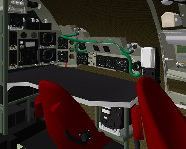
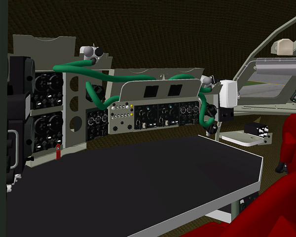
Over the last fortnight, the navigator’s station has been completely remodelled. I need to add detailed textures and some live instruments that duplicated information from the pilots’ panels. Navigators had additional aids to pinpoint their location: a Marconi AD 2100 or 2300 Dopper Radar, to measure ground speed, distance and drift, a Loran APN-9 (see below), and two independent ADF receivers with large, accurate scales. Various slots and bins were provided for books, almanacs, charts for the flight, and storage for oxygen masks.
X-Plane doesn’t support Loran, so the APN 9 is purely cosmetic. In brief, Loran was an American development of the British “Gee” system, used by the R.A.F. during Second World War. Radio transmitters sent out pulses that created waves, like the ripples on a pond. The concentric circles radiating from two transmitters merged to form a grid, and a third transmitter, known as the master, provided synchronisation. The read-out was on a twin-beam oscilloscope, which showed the delay for the signal from each of the two slave transmitters to reach the aircraft, and therefore the deviation from the intended course. Using a specially marked chart, and gradations on the oscilloscope, the navigator could interpret the information and plot his position. Accuracy declined with distance, and was approximately 0.5% of the distance from the transmitters to the aircraft, with a maximum range of 400 miles.
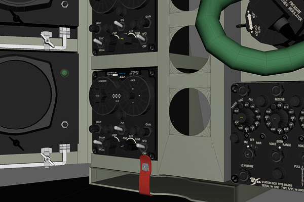
Loran used the same principle as Gee, with three times the range, but half the accuracy (or 1% of the distance between transmitters and receivers). However, Loran’s design objective was to guide ships over long expanses of ocean until they could pick up more accurate local beacons, which it did very well. The APN 9 unit was hardly compact, but it was small enough to be installed in aircraft, and drew less power than earlier versions. It was used in both the Comet and early Boeing 707s.
Jet travel was a strict test of navigation skills. Speeds were greater, so calculation had to be faster to have any kind of accuracy; early jet airliners only just carried enough fuel to cross the Atlantic, so mistakes or inaccuracy could have the most serious consequences; and jets flew higher, so it was harder to use visual references on the ground. For critical routes, B.O.A.C. and the R.A.F. required two navigators. Other routes didn’t warrant that level of attention, especially if they were over land well supported by other radio transmissions and beacons, and the level of equipment for each airline varied widely. For example, some aircraft had a much smaller navigation table for one man. However, I don’t have accurate specifications for each airline, so I’ve standardised on the original, most comprehensive layout.
--
GMM-P (10/07/2009)
blog comments powered by Disqus